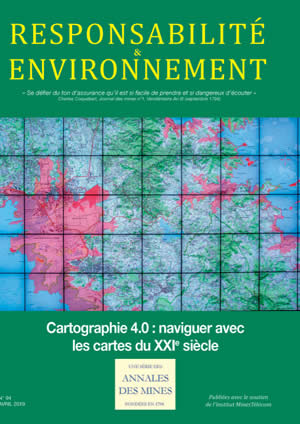
 N° 94 - April 2019 - Cartography 4.0: Maps for navigation in the 21st century N° 94 - April 2019 - Cartography 4.0: Maps for navigation in the 21st century
Issue editor: Françoise Roure and Didier Pillet
Préface : De la carte de Cassini à la Géoplateforme de l’État
Daniel BURSAUX,
Instiut National de l’Information Géographique et Forestère (IGN)
Introduction :
Dr. Françoise ROURE et Didier PILLET
Conseil général de l’Économie
1 - Designing and making cartography 4.0
Earth System, an infrastructure research program of data and services on the cutting edge of digital imagery and cartography
Frédéric Huynh,
director of IR Système Terre;
Nicolas Baghdadi,
IRSTEA, director of the pole Theia;
Michel Diament,
IPGP, director of the pole ForM@Ter;
Nicole Papineau,
CNES, director of the pole AERIS;
Gilbert Maudire,
IFREMER, director of the pole ODATIS;
Richard Moreno,
CNES, technical director of IR Système Terre;
and
Pierre Maurel,
IRSTEA, in charge of Dinamis
A new engine for 3D geospatial data visualization on Géoportail: iTowns
Mirela Konini,
IGN,
Alexandre Devaux
and
Mathieu Brédif,
Paris-Est University, LASTIG GEOVIS, IGN, ENSG
The contribution of SIG 4D to a modern cartography for the 21st century
Marie Lacroix,
Docteur ès Géosciences/Géomatique
Why Standards Matter – The objectives and roadmap of the International Open Geospatial Consortium (OGC)
By Mark REICHARDT
Open Geospatial Consortium (OGC)
and
François ROBIDA
BRGM
Geostatistics for building 3D geological models
Didier Renard and Christian Lajaunie,
Centre de Géosciences, MINES ParisTech – PSL University;
Simon Lopez,
Direction Géoressources/Unité GSO;
Cécile Allanic,
Direction Géoressources/Unité GBS;
Philippe Calcagno,
Direction Géoressources/Unité REG, Bureau de Recherches Géologiques et Minières;
Gabriel Courrioux and Bernard Bourgine,
Direction Géoressources/Unité GSO
On using real-time cartography in immersive cinema: The example of the partnership between ILOI and XD Productions
Jacques Peyrache,
CEO of XD Productions,
and
Alain Séraphine,
president of ILOI
Cartography and visualization
Par Éric GUICHARD
Enssib
2 - Uses of Cartography 4.0
GeoBIM: From managing a territory to managing a building
Dimitri Sarafinof, Bruno Vallet and Laurent Heydel,
IGN;
Arnaud Mistre and Guillaume Picinbono,
CSTB
Digital land maps for transportation and mobility: Opportunities and issues?
Par Yoann NUSSBAUMER
Chargemap
High definition digital maps, mobility’s future: What value will be added to driverless vehicle systems?
Par Vincent MARTINIER
TomTom France
Applications for analyzing AIS data and interactively geovisualizing data
Damien LE GUYADER
and
Matthieu LE TIXERANT
Terra Maris
Maps of farmlands and Farmstar’s services
Philippe GATE, Baptiste SOENEN, Mathilde CLOSSET et Norbert BENAMOU
ARVALIS
et
Hervé POILVÉ et Michel FEUGA
Airbus Defence and Space
Using emergency cartographical services by satellite for civil defense
Stéphanie Battiston, Stephen Clandillon and Robin Faivre,
ICube-SERTIT;
Claire Tinel,
CNES,
and
Annett Wania,
JRC
Observatoire de la Dynamique Côtière de Guyane: Its interactive map, a tool for the sustainable management of Guiana’s coast
Julie Furiga,
coordinator at the Observatoire de la Dynamique Côtière de Guyane (ODyC)
The digital mapping of water basins: Feedback from water agencies
Sarah Feuillette and Patricia Blanc,
Seine-Normandie Water Agency
A regional platform’s impact on local cartographical practices
Christine Archias,
CRIGE Provence-Alpes-Côte d’Azur
KaruGéo: Guadeloupe’s website of geographical information
Anouk Robillard,
KaruGéo
Digital cartography: Progress or a social cleavage?
Claire Tutenuit,
president of the association Le Ruban Vert and delegate of the Association Française des Entreprises pour l’Environnement (EpE)
Miscellany
How to put blockchain technology at the service of the Paris climate agreement
Patrice Geoffron,
Paris-Dauphine University, PSL, Laboratoire d’Économie de Dauphine (LEDa) UMR-CNRS-IRD,
and
Stéphane Voisin,
Institut Louis Bachelier, PSL
|


